Spotting Surveillance Drones at Night

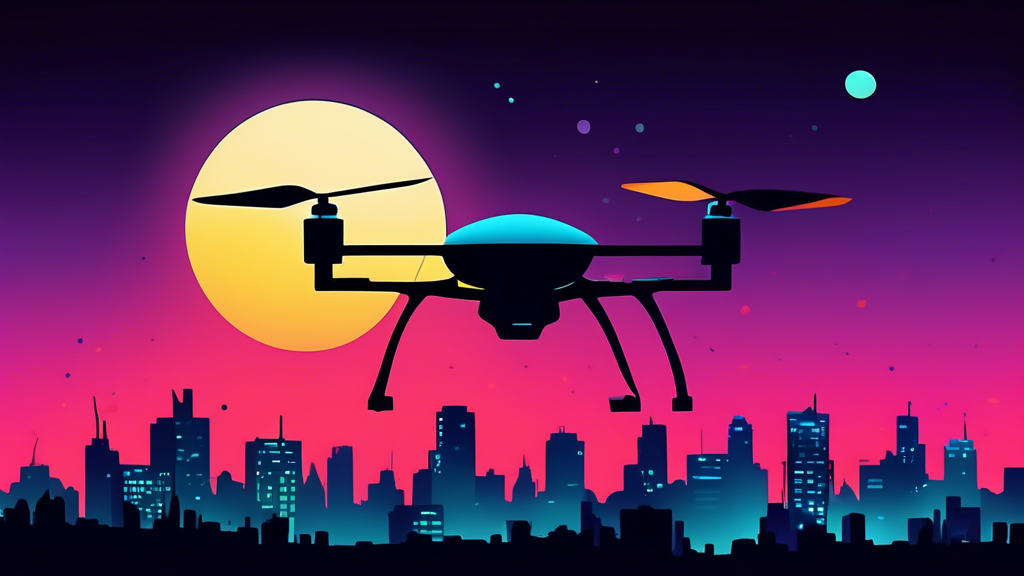
A small dark drone silhouetted against a bright full moon with a city skyline in the background.

The Rise of Drone Surveillance

In an era defined by technological advancements, surveillance drones have become increasingly commonplace. These unmanned aerial vehicles (UAVs) equipped with high-resolution cameras and advanced sensors are deployed for a wide range of purposes, including security, law enforcement, and even recreational activities. While drones are easily recognizable during the day, their presence at night can be more elusive. So, how can you spot surveillance drones after dark?

Understanding Drone Illumination

Unlike traditional aircraft, drones do not have navigation lights that are visible from the ground. The Federal Aviation Administration (FAA) does not mandate lighting on drones, making them difficult to detect at night. However, there are subtle visual cues that can help you identify their presence.

Visible Clues of Drones at Night

While drones themselves may not emit light, the technology they carry can produce noticeable effects. Pay attention to the following:

1. Red and Green Anti-Collision Lights

Some drones, particularly larger or more sophisticated models, may be equipped with red and green anti-collision lights. These lights are not designed for visibility from the ground but serve to prevent mid-air collisions. If you happen to catch a glimpse of these flashing lights, it’s a strong indication of a drone in the vicinity.

2. Infrared (IR) Lights

Many surveillance drones utilize infrared (IR) cameras for night vision capabilities. IR illuminators, which emit infrared light, may be used to enhance the visibility of the camera. While invisible to the naked eye, IR light can appear as a faint red glow when viewed through certain cameras or night vision devices. If you notice an unexplained reddish light source moving in the sky, it could be an IR-equipped drone.

3. Camera Flashes

Drones equipped with conventional cameras may use flashes to illuminate their subjects at night. If you observe a series of bright flashes originating from a moving object in the sky, it could be a drone taking photographs or recording video footage.

4. Sounds of Drones at Night

While visual cues can be subtle, drones often produce distinctive sounds that can help you identify them at night. Listen for the following:

1. Buzzing or Humming Noise

The most common sound associated with drones is a high-pitched buzzing or humming noise. This is produced by the drone’s rotors as they spin rapidly to generate lift. The intensity of the sound may vary depending on the size and type of drone, as well as its distance from you.

2. Whirring or Whining Sound

Some drones, especially larger models, may produce a whirring or whining sound in addition to the buzzing noise. This sound is often associated with the drone’s motors or other mechanical components.

3. Propeller Noise

As the drone’s propellers cut through the air, they can create a distinctive whooshing or chopping sound. This sound is more noticeable at close range or when the drone is maneuvering quickly.

Using Technology to Spot Drones

While human observation can be helpful, technology can significantly enhance your ability to detect drones at night. Consider the following tools:

1. Night Vision Devices

Night vision devices amplify ambient light or utilize infrared illumination to allow you to see in low-light conditions. These devices can be particularly effective in spotting drones that use IR illuminators.

2. Drone Detection Apps

Several smartphone apps are designed specifically for drone detection. These apps use your phone’s microphone to analyze ambient sounds and identify drone-specific noise signatures. Some apps may also provide visual cues, such as arrows pointing in the direction of the detected drone.

3. Radar Systems

Radar systems are highly effective in detecting drones, even at night. These systems emit radio waves that bounce off objects in the vicinity, including drones. By analyzing the reflected waves, radar systems can determine the location, speed, and direction of the drone.

Factors Affecting Drone Visibility

Several factors can influence the visibility of drones at night, including:

1. Drone Size and Design

Larger drones with complex designs are generally more visible than smaller, simpler models. This is because larger drones tend to have more surface area to reflect ambient light and may also be equipped with more powerful lights or illuminators.

2. Altitude and Distance

Drones flying at higher altitudes or greater distances are naturally more difficult to spot. As the distance between you and the drone increases, the visual and auditory cues become fainter.

3. Weather Conditions

Fog, rain, and cloud cover can significantly reduce visibility and make it challenging to spot drones at night. Adverse weather conditions can also affect the performance of drone detection systems.

4. Ambient Light Levels

The amount of ambient light present can greatly influence drone visibility. In areas with significant light pollution from streetlights, buildings, or other sources, drones may be more easily obscured.

Protecting Your Privacy

If you are concerned about drone surveillance, there are steps you can take to protect your privacy:

1. Be Aware of Your Surroundings

Pay attention to unusual sounds or lights in your neighborhood, especially at night. If you suspect a drone is present, try to identify its location and movement patterns.

2. Use Privacy Screens

Install privacy screens or fences around your property to create visual barriers and make it more difficult for drones to observe your activities. Trees and shrubs can also provide natural screening.

3. Drone Detection Systems

Consider investing in a drone detection system for your home or business. These systems can alert you to the presence of drones in your airspace and provide information about their location and characteristics.

4. Anti-Drone Technologies

Various anti-drone technologies are being developed, such as radio frequency jammers and laser systems. These technologies aim to disrupt drone operations or disable them entirely. However, the legality and ethical implications of using such technologies are still being debated.

Conclusion

Spotting surveillance drones at night requires a keen eye, an understanding of drone technology, and possibly the assistance of specialized tools. While drones themselves may not be illuminated, their onboard equipment and operational characteristics can provide telltale signs of their presence. By paying attention to visual and auditory cues, utilizing drone detection technologies, and taking steps to protect your privacy, you can better navigate the increasingly complex world of drone surveillance. Remember, knowledge is power, and understanding how to identify and address potential drone surveillance is essential in today’s technological landscape.

 

Understanding Drone Functionality

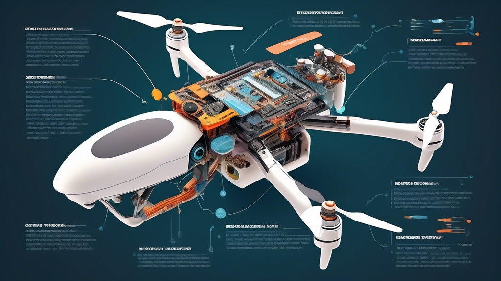
A cutaway diagram of a drone, showcasing its internal components and technology, with labels explaining each part's function.

What Do Drones Do? Exploring the Diverse Functionality of Drones

Drones, also known as unmanned aerial vehicles (UAVs), have soared beyond their initial military applications to become versatile tools across various industries. From aerial photography to package delivery, drones offer a wide range of capabilities. But what exactly do drones do? Let’s delve into the multifaceted functionality of these modern marvels.

1. Aerial Photography and Videography: Capturing Stunning Perspectives

Drones have revolutionized the way we capture aerial imagery. Equipped with high-resolution cameras and advanced stabilization systems, drones can capture breathtaking photos and videos from unique vantage points. This capability has transformed industries like:

  • Filmmaking and Photography: Drones provide filmmakers and photographers with dynamic shots and perspectives previously unattainable without expensive helicopters.
  • Real Estate: Showcase properties from captivating angles, offering potential buyers a comprehensive view of the property and its surroundings.
  • Construction: Monitor construction progress, inspect infrastructure, and create detailed aerial surveys of project sites.

2. Delivery and Logistics: Streamlining Transportation

The use of drones for delivery is rapidly gaining traction. Drones offer a faster, more efficient, and cost-effective solution for transporting goods, particularly in areas with challenging terrain or traffic congestion. Their applications in delivery and logistics include:

  • Package Delivery: Companies like Amazon are exploring drone delivery to expedite package transportation, reducing delivery times and costs.
  • Medical Supply Delivery: Drones can deliver essential medical supplies, including blood and organs, to remote areas or disaster zones, saving lives and improving healthcare access.
  • Inventory Management: Drones can scan and track inventory in warehouses and distribution centers, optimizing logistics and reducing errors.

3. Agriculture: Enhancing Farming Practices

Drones are transforming the agricultural landscape by providing farmers with powerful tools to improve crop management, increase yields, and reduce costs. Their applications in agriculture include:

  • Crop Monitoring: Drones equipped with multispectral or hyperspectral cameras can capture images that reveal plant health, stress levels, and irrigation needs, enabling farmers to take targeted actions.
  • Precision Spraying: Drones can precisely apply fertilizers, pesticides, and herbicides, reducing chemical usage and minimizing environmental impact.
  • Livestock Monitoring: Drones can herd livestock, monitor their health, and detect potential issues, improving animal welfare and farm efficiency.

4. Surveillance and Security: Enhancing Safety and Monitoring

Drones provide a versatile platform for surveillance and security purposes, offering a bird’s-eye view of areas and enabling real-time monitoring. Their applications in surveillance and security include:

  • Law Enforcement: Drones assist law enforcement agencies in search and rescue operations, crime scene investigation, and traffic monitoring.
  • Border Patrol: Drones enhance border security by patrolling vast areas, detecting illegal crossings, and providing real-time situational awareness.
  • Infrastructure Inspection: Drones inspect bridges, power lines, pipelines, and other critical infrastructure for damage, corrosion, or potential safety hazards.

5. Search and Rescue: Aiding in Emergency Response

Drones play a crucial role in search and rescue operations, enabling rapid deployment and coverage of vast areas, often inaccessible by traditional means. Their applications in search and rescue include:

  • Locating Missing Persons: Drones equipped with thermal cameras can detect heat signatures, aiding in the search for missing hikers, climbers, or individuals lost in wilderness areas.
  • Disaster Response: Drones provide aerial views of disaster zones, assessing damage, identifying survivors, and guiding rescue efforts.
  • Mountain Rescue: Drones deliver essential supplies to climbers stranded in remote or inaccessible areas, providing life-saving support.

6. Environmental Monitoring: Protecting Our Planet

Drones are invaluable tools for environmental monitoring, providing insights into ecosystem health, wildlife populations, and environmental changes. Their applications in environmental monitoring include:

  • Wildlife Conservation: Drones track animal movements, monitor populations, and assess habitat health, supporting conservation efforts.
  • Forestry Management: Drones map forest areas, monitor tree health, and detect signs of deforestation or disease, aiding in sustainable forestry practices.
  • Pollution Monitoring: Drones equipped with sensors can detect air and water pollution, providing data for environmental protection initiatives.

7. Research and Exploration: Unveiling New Discoveries

Drones are expanding the horizons of research and exploration, enabling scientists and researchers to gather data from challenging or inaccessible locations. Their applications in research and exploration include:

  • Archaeology: Drones create aerial maps of archaeological sites, revealing hidden structures and providing valuable insights into ancient civilizations.
  • Oceanography: Drones study marine life, map ocean floors, and monitor ocean currents, contributing to our understanding of the marine environment.
  • Volcanology: Drones collect data from active volcanoes, monitoring volcanic activity, and providing early warnings of potential eruptions.

8. Entertainment and Recreation: Enhancing Leisure Activities

Beyond their practical applications, drones have also become popular recreational tools, offering enthusiasts new ways to enjoy hobbies and explore the world from unique perspectives. Their applications in entertainment and recreation include:

  • Drone Racing: Drone racing is a rapidly growing sport where pilots navigate drones through challenging courses at high speeds, testing their skills and agility.
  • Aerial Photography and Videography: Hobbyists use drones to capture stunning aerial footage of landscapes, events, and their adventures, sharing their unique perspectives with the world.
  • Drone Light Shows: Choreographed drone light shows create mesmerizing aerial displays, captivating audiences with synchronized movements and vibrant colors.

Conclusion

Drones have become an integral part of modern society, impacting a wide range of industries and aspects of our lives. From aerial photography and delivery to agriculture, surveillance, and environmental monitoring, the functionality of drones continues to evolve, offering new possibilities and transforming the way we live, work, and explore our world. As technology advances, we can expect even more innovative applications for drones, further expanding their impact on society.

testing

Please provide the article title so I can write a DALL-E prompt for it.

How Drones Work: A Comprehensive Guide

Drones have evolved from niche gadgets to commonplace tools, used for everything from photography and filmmaking to surveillance and delivery. But have you ever wondered how these unmanned aerial vehicles actually stay aloft and perform complex maneuvers? In this comprehensive guide, we’ll delve into the fascinating mechanics of drones, exploring the key components and principles that make them fly.

1. Anatomy of a Drone

To understand how drones work, we need to break down their essential components:

a) Frame

The frame provides the structural foundation of a drone. Typically made of lightweight and durable materials like carbon fiber or plastic, it houses all the other components and determines the drone’s overall shape and size.

b) Motors

Drones employ multiple motors, usually four or more, to power their propellers. These motors are typically brushless DC motors, known for their efficiency, power, and longevity. They convert electrical energy from the battery into mechanical energy, driving the propellers.

c) Propellers

Attached to the motors, propellers are airfoil-shaped blades that generate thrust by moving air downwards. The angle and speed of the propellers are precisely controlled to enable the drone to move in different directions.

d) Battery

The battery is the drone’s energy source, providing power to the motors, sensors, and other electronic components. Lithium polymer (LiPo) batteries are commonly used due to their high energy density and lightweight nature. Battery capacity directly impacts the drone’s flight time.

e) Electronic Speed Controllers (ESCs)

ESCs act as intermediaries between the battery and the motors. They regulate the amount of power supplied to the motors, enabling precise control over propeller speed and direction.

f) Flight Controller

The flight controller is the drone’s brain, a sophisticated electronic board that manages all aspects of flight. It receives input from sensors and the pilot’s commands, processing this data to adjust motor speeds and maintain stability.

g) Sensors

Drones are equipped with a variety of sensors, including accelerometers, gyroscopes, and barometers, which provide crucial information about the drone’s orientation, altitude, and speed. These sensors allow the flight controller to make real-time adjustments, ensuring smooth and stable flight.

h) GPS Module

The GPS module allows the drone to determine its location and navigate autonomously. It receives signals from GPS satellites, enabling features like waypoint navigation and return-to-home functionality.

i) Camera and Gimbal

Many drones come equipped with high-quality cameras mounted on motorized gimbals. The gimbal stabilizes the camera, providing smooth footage even during flight, while the camera captures photos and videos.

2. Principles of Flight

Now that we understand the components, let’s explore the aerodynamic principles that make drones fly:

a) Thrust

As the propellers spin, they push air downwards, generating an upward force known as thrust. When the thrust force exceeds the drone’s weight, the drone takes off.

b) Drag

Drag is the air resistance that opposes the drone’s motion. Streamlined design and efficient propellers help minimize drag, allowing for faster speeds and longer flight times.

c) Lift

Lift is generated by the shape and angle of the propellers, similar to how airplane wings generate lift. The propellers’ airfoil design creates an area of low pressure above them and high pressure below, resulting in an upward force.

d) Weight

The weight of the drone, including all its components and payload, acts as a downward force. Balancing thrust and weight is crucial for controlled flight.

e) Yaw, Pitch, and Roll

Drones maneuver by adjusting the speed of individual propellers. Yaw refers to rotation around the vertical axis (like turning left or right), pitch refers to tilting forward or backward, and roll refers to tilting side to side.

3. Flight Control System

The flight controller is the heart of a drone’s operation, coordinating all flight functions. It receives input from the pilot’s remote control and the onboard sensors, using sophisticated algorithms to adjust motor speeds and maintain stability.

a) Pilot Input

The pilot uses a remote control to send commands to the drone, controlling its movement and altitude. These commands are translated into signals that the flight controller understands.

b) Sensor Data

The flight controller constantly monitors data from the drone’s sensors, including its orientation, altitude, and speed. This information is crucial for maintaining stability and executing precise maneuvers.

c) PID Controller

The flight controller utilizes a Proportional-Integral-Derivative (PID) controller, a sophisticated feedback mechanism that adjusts motor speeds based on the desired flight parameters and sensor data. The PID controller ensures smooth and accurate flight by constantly correcting for deviations from the desired state.

4. Battery Life and Flight Time

Battery capacity is a major determinant of a drone’s flight time. Higher capacity batteries provide longer flight times but also increase the drone’s weight. Efficient motors, propellers, and aerodynamic design can extend flight time by reducing energy consumption.

5. Safety Features

Modern drones incorporate numerous safety features to mitigate risks and ensure responsible operation:

a) GPS-Based Return-to-Home

This feature enables the drone to automatically return to its launch location in case of signal loss or low battery.

b) Obstacle Avoidance Systems

Some drones are equipped with sensors that detect and avoid obstacles, preventing collisions.

c) Geofencing

Geofencing creates virtual boundaries that restrict the drone’s flight area, preventing it from straying into restricted airspace.

d) Fail-Safe Mechanisms

Drones have fail-safe mechanisms that activate in case of critical failures, such as motor malfunction or loss of control. These mechanisms may include automatic landing or controlled descent.

6. Applications of Drones

Drones have revolutionized various industries, offering innovative solutions for a wide range of applications:

a) Aerial Photography and Videography

Drones provide stunning aerial perspectives for photography and videography, capturing breathtaking landscapes, cinematic shots, and unique angles.

b) Surveillance and Inspection

Drones can inspect infrastructure, monitor crops, survey disaster areas, and perform security surveillance, providing valuable data and insights.

c) Delivery and Logistics

Drones are being explored for package delivery, medical supply transportation, and other logistics applications, offering faster and more efficient solutions.

d) Search and Rescue

Drones can assist in search and rescue operations, covering vast areas quickly and locating missing persons or survivors.

e) Research and Development

Drones serve as versatile platforms for research and development, enabling aerial data collection, environmental monitoring, and scientific experimentation.

Conclusion

Drones have transformed our world, offering unprecedented capabilities and unlocking new possibilities. Understanding how these remarkable machines work allows us to appreciate their complexity, capabilities, and the vast potential they hold for the future. As technology continues to evolve, drones are poised to play an even more significant role in various aspects of our lives.

DJI Drone Manufacturing Locations

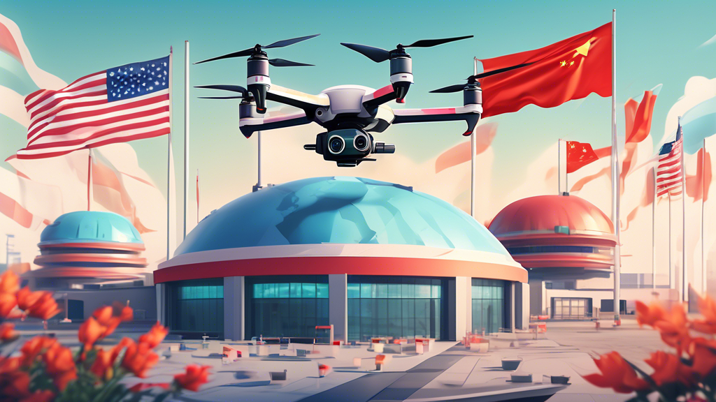
A DJI drone hovering over a futuristic factory complex with the flags of China, USA, and Holland waving in the foreground.

Where Are DJI Drones Made?

DJI, the world’s leading drone manufacturer, is renowned for its cutting-edge technology and innovative aerial platforms. But have you ever wondered where these sophisticated drones are actually made? In this article, we’ll delve into the manufacturing locations of DJI drones, exploring the company’s global footprint and the reasons behind its production choices.

DJI’s Primary Manufacturing Base: Shenzhen, China

Shenzhen, a bustling metropolis in southern China, serves as the primary manufacturing hub for DJI. Known as China’s Silicon Valley, Shenzhen boasts a thriving tech ecosystem, providing access to a skilled workforce, advanced manufacturing capabilities, and a robust supply chain. DJI’s headquarters and main production facilities are located in this vibrant city.

Shenzhen’s strategic location offers several advantages for DJI’s manufacturing operations:

  • Access to a vast pool of skilled labor: Shenzhen is home to a large concentration of engineers, technicians, and manufacturing experts, providing DJI with a readily available workforce.
  • Proximity to component suppliers: The Pearl River Delta region, where Shenzhen is located, is a major hub for electronics manufacturing. This proximity to component suppliers streamlines DJI’s supply chain and reduces production costs.
  • Advanced manufacturing infrastructure: Shenzhen boasts state-of-the-art manufacturing facilities and infrastructure, enabling DJI to produce high-quality drones at scale.
  • Government support and incentives: The Chinese government has actively promoted the growth of the tech industry in Shenzhen, providing incentives and support to companies like DJI.

Global Expansion and Manufacturing Partnerships

While Shenzhen remains DJI’s primary manufacturing base, the company has expanded its global footprint in recent years. DJI has established manufacturing partnerships and facilities in other countries to meet growing demand and cater to specific market needs.

United States

DJI has a manufacturing facility in California, USA, focusing on the production of drones for the North American market. This facility allows DJI to reduce shipping times and better serve its customers in the region.

Southeast Asia

DJI has also explored manufacturing partnerships in Southeast Asian countries like Vietnam and Malaysia. These partnerships provide access to cost-effective labor and manufacturing capabilities while diversifying DJI’s production base.

Factors Influencing DJI’s Manufacturing Locations

Several factors influence DJI’s decisions regarding manufacturing locations, including:

  • Cost of labor and production: Labor costs and manufacturing expenses vary significantly across different regions. DJI aims to optimize production costs while maintaining high quality standards.
  • Proximity to target markets: Manufacturing drones closer to key markets reduces shipping times and costs, improving customer satisfaction.
  • Access to skilled labor: Availability of a skilled workforce is crucial for producing complex drones with precision and expertise.
  • Supply chain efficiency: Establishing manufacturing facilities near component suppliers streamlines the supply chain and ensures timely production.
  • Government policies and incentives: Government policies and incentives can significantly influence manufacturing decisions, offering tax breaks, subsidies, and other benefits.

Quality Control and Standards

Regardless of the manufacturing location, DJI maintains strict quality control standards across all its production facilities. The company employs rigorous testing procedures and quality assurance measures to ensure that all drones meet its high standards for performance, reliability, and safety.

DJI’s commitment to quality is evident in its certifications and accreditations, including ISO 9001 for quality management systems. The company’s drones undergo extensive testing to meet industry regulations and safety standards.

Conclusion

DJI’s manufacturing operations are strategically distributed across the globe, with its primary base in Shenzhen, China. The company’s global footprint reflects its commitment to meeting growing demand, optimizing production costs, and serving diverse markets. By leveraging a combination of in-house manufacturing and strategic partnerships, DJI ensures the production of high-quality drones that continue to revolutionize aerial technology.

testing

A photorealistic image of a man wearing a gray suit and tie, looking at the camera with a stern expression, while a hand reaches out from a laptop screen and covers his mouth.

What Drones Need To Be Registered? A Comprehensive Guide

The world of drones is exciting and rapidly evolving, offering incredible opportunities for recreation, photography, videography, and even commercial applications. However, it’s crucial to understand that not all drones are created equal, and certain regulations apply depending on their weight and intended use. One key aspect of responsible drone ownership is registration. So, what drones need to be registered?

Understanding Drone Registration Requirements

In many countries, including the United States, Canada, and the United Kingdom, drone registration is mandatory for most drones that weigh over a certain threshold. This is primarily due to safety and security concerns. Unregistered drones pose potential risks to airspace, property, and public safety if not operated responsibly.

Weight Thresholds for Drone Registration

The specific weight limit for drone registration varies by country. Here’s a breakdown of the general guidelines:

  • **United States:** Drones weighing between 0.55 pounds (250 grams) and 55 pounds (25 kilograms) must be registered with the Federal Aviation Administration (FAA).
  • **Canada:** Drones weighing more than 250 grams require registration with Transport Canada.
  • **United Kingdom:** Drones weighing over 250 grams need to be registered with the Civil Aviation Authority (CAA).

Types of Drones That Typically Require Registration

Given the weight thresholds mentioned above, several popular consumer drone models fall under the registration requirement. These include:

  • **DJI Mavic series:** Mavic Pro, Mavic Air, Mavic 2 Pro/Zoom, etc.
  • **DJI Phantom series:** Phantom 3/4, Phantom 4 Pro, etc.
  • **Parrot Anafi series:** Anafi, Anafi FPV, etc.
  • **Autel Robotics EVO series:** EVO II, EVO II Pro, etc.
  • **Yuneec Typhoon series:** Typhoon H, Typhoon H Plus, etc.

Exceptions to Drone Registration

There are a few exceptions to the general registration rules. These typically include:

  • **Drones under the weight threshold:** Drones weighing less than the specified limit (e.g., 250 grams) usually don’t need registration.
  • **Toys and model aircraft:** Certain toy drones and model aircraft may be exempt from registration if they meet specific criteria, such as being flown exclusively for recreational purposes within designated areas.
  • **Drones used for commercial operations:** In many countries, commercial drone operations require additional certifications and permits beyond basic registration.

How to Register Your Drone

The process of registering your drone is typically straightforward and can often be completed online. You will need to provide information about yourself, the drone, and its intended use. There is usually a small registration fee involved.

Here’s a general overview of the registration process:

  1. **Identify the relevant aviation authority:** Determine the appropriate agency responsible for drone registration in your country (e.g., FAA in the US, Transport Canada in Canada, CAA in the UK).
  2. **Create an account:** Sign up for an account on the agency’s online portal or website.
  3. **Provide drone information:** Enter details about your drone, such as its make, model, weight, and serial number.
  4. **Pay the registration fee:** Submit the required fee to complete the registration process.
  5. **Mark your drone:** Once registered, you will receive a registration number that must be displayed on your drone.

Benefits of Drone Registration

Drone registration offers several benefits, including:

  • **Enhanced safety:** Registration helps authorities track drones and identify operators in case of accidents or incidents.
  • **Improved accountability:** It promotes responsible drone ownership and discourages illegal or reckless flying.
  • **Education and awareness:** The registration process often includes educational materials about drone safety regulations and best practices.

Consequences of Not Registering Your Drone

Failure to register a drone that requires registration can lead to penalties, including fines and potential legal action. It’s essential to comply with local regulations to avoid these consequences.

Staying Informed and Flying Responsibly

Drone regulations are subject to change, so it’s crucial to stay updated on the latest requirements in your area. Always fly your drone responsibly, respecting privacy, safety, and the environment.

Best Drone Flight Locations Near You

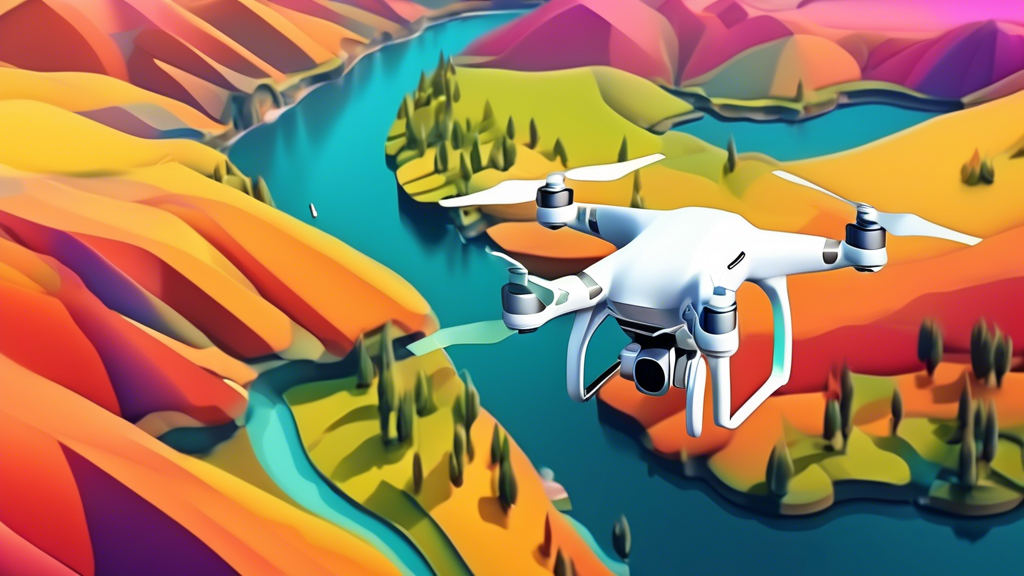
A drone flying over a scenic landscape, capturing aerial photography

Finding the Perfect Launchpad

The thrill of piloting a drone and capturing breathtaking aerial footage is unparalleled. However, before you take to the skies, it’s crucial to identify safe and legal flying zones for your drone adventures. With regulations varying across regions, pinpointing the ideal location can be a challenge. Fret not, aspiring drone pilots, for we’re here to guide you on your quest for the perfect launchpad!

1. Embrace the Great Outdoors: Parks and Recreation Areas

Local parks and recreational areas often provide ample space for drone flight, making them a popular choice among enthusiasts. However, it’s essential to check local ordinances and park regulations beforehand, as some may have restrictions or designated flying zones. Researching online or contacting park authorities can save you from unexpected hassles.

2. Unleash Your Drone in Open Fields and Farmlands

Vast open fields and farmlands offer unobstructed airspace and stunning panoramic views, perfect for capturing breathtaking drone footage. If you’re considering these locations, seek permission from landowners to ensure a smooth and respectful flying experience. Respecting private property is paramount to maintaining positive relationships within the community.

3. Explore the Wilderness: National Forests and BLM Lands

For the adventurous drone pilot, national forests and BLM (Bureau of Land Management) lands present a treasure trove of scenic landscapes. These expansive areas typically allow drone flight, but it’s crucial to adhere to any specific guidelines or restrictions set forth by the managing agencies. Responsible flying ensures the preservation of these natural wonders.

4. Soar Above the Shoreline: Beaches and Coastal Areas

The allure of capturing coastal beauty from a bird’s-eye view is undeniable. Beaches and coastal areas can offer fantastic drone flying opportunities, but be mindful of local regulations and potential restrictions due to wildlife protection or nesting areas. Additionally, strong winds and interference from seagulls are factors to consider when planning your coastal drone adventure.

5. Seek Specialized Flying Sites: Drone Parks and Clubs

Dedicated drone parks and clubs are popping up across the country, providing safe and controlled environments for enthusiasts to hone their skills. These venues often feature obstacle courses, landing pads, and a community of passionate drone pilots eager to share their knowledge and experiences. Joining a local club can open doors to a world of camaraderie and learning.

6. Elevate Your Urban Exploration: City Parks and Designated Zones

While urban areas present more challenges for drone flight due to population density and potential hazards, some cities have designated zones or parks where drone flying is permitted. Researching local regulations and identifying these designated areas is essential for a safe and enjoyable urban drone experience.

7. Respecting Privacy and Safety

Regardless of your chosen location, prioritizing safety and respecting privacy are paramount. Always maintain a safe distance from people, buildings, and other aircraft. Avoid flying over private property without permission, and be mindful of noise levels to minimize disturbance. Responsible drone operation ensures a positive experience for everyone.

Navigating the Regulatory Landscape

Drone regulations can vary significantly depending on your location. The Federal Aviation Administration (FAA) governs drone flight in the United States, while other countries have their own aviation authorities and guidelines. Familiarizing yourself with the specific rules and requirements in your area is essential to avoid potential fines or legal issues.

Essential Resources for Drone Pilots

Several online resources can assist you in finding suitable drone flying locations and understanding local regulations. The FAA’s B4UFLY app provides real-time information on airspace restrictions and advisories, while websites like AirMap offer interactive maps displaying no-fly zones and other relevant data. Additionally, local drone clubs and online communities can provide valuable insights and support.

testing

## DALL-E Prompt:nnA surreal photograph of a lone astronaut lost in a labyrinth of giant, floating books, bathed in the ethereal glow of a distant nebula.

How Big Are Military Drones?

Military drones, also known as Unmanned Aerial Vehicles (UAVs), come in a wide range of sizes, each tailored to specific missions and capabilities. From small, hand-launched models to large, high-altitude aircraft, the size of a military drone directly impacts its function, range, and payload capacity.

Micro and Miniature Drones: The Tiny Titans of Surveillance

At the smallest end of the spectrum, we have micro and miniature drones, often used for close-range surveillance and reconnaissance. These drones can be as small as a few inches in length, with some even resembling small birds or insects. Their compact size allows them to navigate tight spaces, making them ideal for urban operations or indoor exploration.

Examples of micro drones include the Black Hornet Nano, used by several militaries for its exceptional portability and stealth capabilities. These drones are typically hand-launched and can provide real-time video feeds to operators on the ground.

Small Tactical Drones: The Workhorses of Modern Warfare

Moving up in size, we encounter small tactical drones, a category encompassing a variety of platforms with diverse capabilities. These drones range from a few feet to several meters in wingspan and are designed for tasks such as battlefield reconnaissance, target acquisition, and light payload delivery.

The RQ-7 Shadow and RQ-11 Raven are well-known examples of small tactical drones, widely employed by the US military and its allies. These drones offer extended flight times and can carry payloads such as electro-optical/infrared (EO/IR) cameras and laser designators.

Medium-Altitude, Long-Endurance (MALE) Drones: The Eyes in the Sky

MALE drones represent a significant step up in size and capability. These aircraft boast impressive endurance, often exceeding 24 hours of continuous flight, and operate at medium altitudes, typically between 10,000 and 30,000 feet. Their primary functions include intelligence gathering, surveillance, and reconnaissance over large areas.

The MQ-9 Reaper and MQ-1 Predator are iconic examples of MALE drones, renowned for their versatility and effectiveness in various military operations. These drones can carry a range of payloads, including Hellfire missiles, laser-guided bombs, and advanced sensor systems.

High-Altitude, Long-Endurance (HALE) Drones: Reaching for the Stratosphere

HALE drones represent the pinnacle of unmanned aerial systems, operating at altitudes exceeding 60,000 feet and remaining airborne for days at a time. These drones are designed for strategic missions, providing persistent surveillance over vast areas and acting as communication relays.

The RQ-4 Global Hawk is a prime example of a HALE drone, capable of covering immense distances and carrying sophisticated sensor suites for intelligence gathering. Its high-altitude capability allows it to operate above most weather disturbances and air defense systems.

Beyond Size: The Evolution of Military Drones

While size plays a crucial role in determining a drone’s capabilities, other factors contribute to their effectiveness and versatility. Advancements in materials science, propulsion systems, and autonomous flight control are constantly pushing the boundaries of drone technology.

Future military drones are expected to exhibit even greater autonomy, allowing them to perform complex missions with minimal human intervention. Additionally, swarm technology, where multiple drones cooperate as a single unit, holds significant potential for overwhelming adversary defenses and conducting coordinated attacks.

The Impact of Drone Size on Military Operations

The varying sizes of military drones offer commanders a wide array of options, enabling them to tailor their aerial assets to specific mission requirements. Smaller drones provide agility and covertness, ideal for close-quarters operations, while larger platforms offer extended range, endurance, and the ability to carry heavier payloads.

The continued development and deployment of military drones of all sizes have revolutionized modern warfare, providing unparalleled reconnaissance capabilities, precision strike options, and a reduced risk to human pilots.

Remote ID for Drones: Explained

This is a test of the alt text

What is Remote ID?

Remote ID is a cutting-edge technology that’s revolutionizing the drone industry. Essentially, it acts as a digital license plate for drones, broadcasting identification and location information in real-time. Think of it as a virtual air traffic control system for unmanned aerial vehicles (UAVs). This system enhances safety and security within the airspace, enabling authorities and other airspace users to identify and track drones during flight.

How Does Remote ID Work?

Remote ID utilizes radio frequencies to transmit crucial data about a drone in flight. This information typically includes:

  • Unique Drone ID
  • Location (latitude, longitude, altitude)
  • Velocity
  • Takeoff Location
  • Control Station Location (for piloted drones)
  • Emergency Status

The transmission methods for Remote ID can vary. Some drones might have built-in broadcast modules, while others might require external devices to comply with Remote ID regulations.

Why is Remote ID Important?

The implementation of Remote ID brings forth numerous benefits for the drone industry and beyond:

  • **Enhanced Safety:** Remote ID allows authorities and other drone pilots to identify and track drones in the airspace, reducing the risk of collisions and unauthorized drone operations near sensitive areas.
  • **Improved Security:** By providing real-time location data, Remote ID assists law enforcement in identifying and apprehending operators who misuse drones for illegal activities.
  • **Accountability and Transparency:** Remote ID promotes responsible drone usage by making operators accountable for their actions, fostering trust within communities and the public.
  • **Integration with Manned Aircraft:** Remote ID paves the way for the safe integration of drones into the national airspace system alongside manned aircraft.
  • **Unlocking Advanced Operations:** With Remote ID in place, regulators can consider granting permissions for more complex drone operations, such as beyond visual line of sight (BVLOS) flights, opening doors to new commercial drone applications.

Remote ID Regulations

Several countries are actively developing and implementing Remote ID regulations to ensure safe and responsible drone usage. The specifics of these regulations may vary but generally encompass aspects such as:

  • **Technical Standards:** Defining the required message format, transmission protocols, and performance standards for Remote ID equipment.
  • **Equipment Requirements:** Specifying the types of drones that must be equipped with Remote ID and any necessary external devices.
  • **Operational Requirements:** Outlining the rules for operating drones with Remote ID, including airspace restrictions and flight permissions.
  • **Data Privacy:** Establishing guidelines on data collection, storage, and access to protect the privacy of drone operators and other stakeholders.

Implications for Drone Pilots

Drone pilots need to stay informed about the evolving Remote ID regulations in their respective regions. Key considerations include:

  • **Compliance:** Ensure your drone complies with the Remote ID requirements or equip it with necessary external devices.
  • **Registration:** Register your drone and obtain any necessary licenses or permits as per local regulations.
  • **Operational Awareness:** Understand the airspace restrictions and flight permissions related to Remote ID operations.
  • **Privacy Considerations:** Be aware of how your data is collected and used within the Remote ID system.

The Future of Remote ID

Remote ID represents a significant step forward in the development of a robust and secure drone ecosystem. As technology advances and regulations mature, we can expect even more sophisticated Remote ID solutions with enhanced capabilities. This will further improve airspace safety, unlock new possibilities for drone applications, and pave the way for the seamless integration of drones into our everyday lives.

Drone Flight Explained

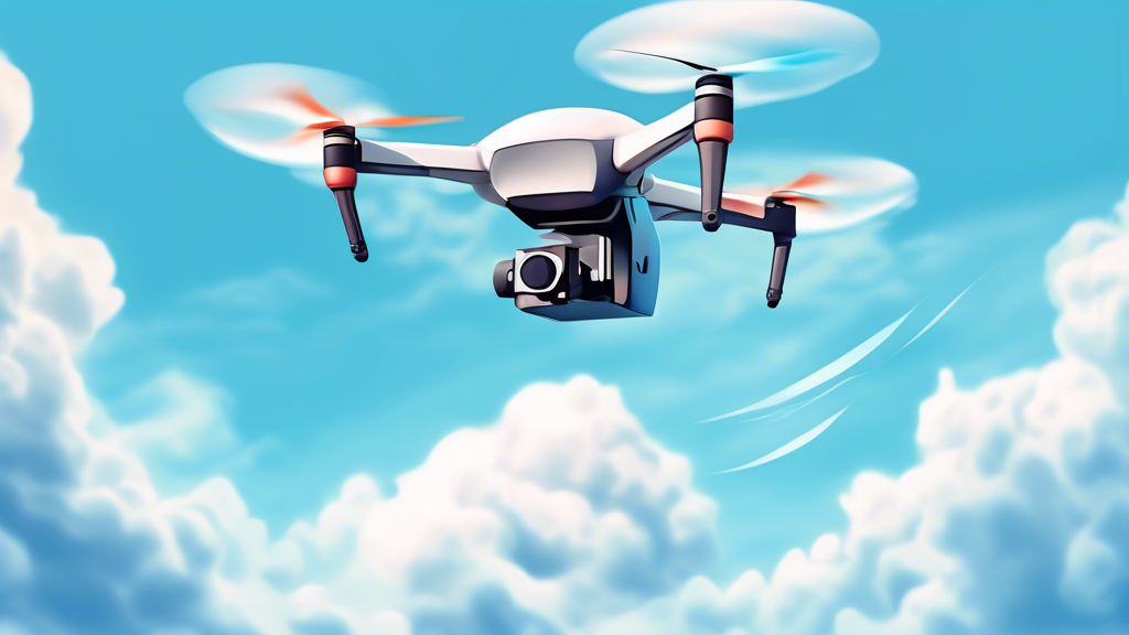
A drone flying through a blue sky with white clouds

How Do Drones Fly?

Drones, also known as unmanned aerial vehicles (UAVs), have become increasingly popular in recent years for various applications, from aerial photography and videography to delivery services and surveillance. But have you ever wondered how these fascinating machines manage to stay airborne? The science behind drone flight involves a complex interplay of physics, aerodynamics, and sophisticated technology.

The Role of Physics in Drone Flight

At its core, drone flight is governed by the principles of physics, particularly the four forces of flight: lift, thrust, drag, and gravity.

Lift

Lift is the upward force that opposes gravity and keeps the drone airborne. Drones generate lift using their rotating propellers, which are essentially spinning wings. As the propellers spin, they create a pressure difference between the upper and lower surfaces of the blades. The upper surface has lower pressure, while the lower surface has higher pressure. This pressure difference creates an upward force known as lift.

Thrust

Thrust is the force that propels the drone forward. It is generated by the propellers pushing air backward. The amount of thrust produced depends on the size and pitch of the propellers, as well as the speed at which they rotate.

Drag

Drag is the force that opposes the drone’s motion through the air. It is caused by the friction between the drone’s surfaces and the air molecules. Streamlined designs and smooth surfaces help to reduce drag.

Gravity

Gravity is the force that pulls the drone down towards the earth. To stay airborne, the lift generated by the drone must be greater than or equal to the force of gravity.

Drone Components and Their Functions

Several key components work together to enable drone flight:

Propellers

Propellers are the most critical components for generating lift and thrust. Most drones have four propellers, arranged in a quadcopter configuration. By varying the speed of individual propellers, the drone can control its movement in different directions.

Motors

Each propeller is driven by a brushless motor, which provides the necessary power for rotation. Brushless motors are efficient and offer precise control, making them ideal for drone applications.

Electronic Speed Controllers (ESCs)

ESCs regulate the speed of the motors, allowing for precise control of the propellers’ rotational speed. They translate the signals from the flight controller into power adjustments for the motors.

Flight Controller

The flight controller is the brain of the drone. It receives input from the remote control, sensors, and other components and sends commands to the ESCs and motors to control the drone’s movement and stability.

Sensors

Drones use various sensors, such as gyroscopes, accelerometers, and barometers, to gather information about their position, altitude, and orientation. This data is fed to the flight controller, which uses it to maintain stability and control.

Battery

The battery provides the power necessary for the motors, flight controller, and other electronic components. Battery life is a crucial factor in drone flight time.

Aerodynamics and Drone Design

The design of a drone plays a significant role in its flight performance. Aerodynamic principles are applied to optimize lift, reduce drag, and enhance stability.

Wing Shape and Design

Drone propellers are essentially wings that rotate. The shape and design of the propeller blades, including their airfoil, pitch, and size, affect the amount of lift and thrust generated.

Body Design

The drone’s body is designed to be as lightweight and streamlined as possible to minimize drag. Smooth surfaces and aerodynamic shapes help reduce air resistance.

Center of Gravity

The center of gravity is the point where the drone’s weight is evenly distributed. It is essential to have the center of gravity located correctly to ensure stability and control.

Controlling Drone Flight

Drones are typically controlled using a remote control that sends radio signals to the drone’s receiver. The remote control allows the pilot to adjust the speed of the motors, control the drone’s direction, and activate various functions.

Pitch, Roll, and Yaw

Drone movement is controlled through three axes: pitch, roll, and yaw.

  • Pitch: Tilting the drone forward or backward.
  • Roll: Tilting the drone side to side.
  • Yaw: Rotating the drone clockwise or counterclockwise.

By manipulating these axes, the pilot can maneuver the drone in any direction.

History of Drones

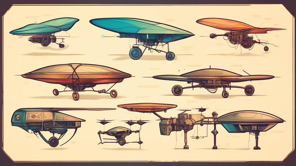
A timeline of drones, from da Vinci's ornithopter to a modern military drone

Early Concepts and Prototypes (1900s – 1960s)

The concept of unmanned aerial vehicles (UAVs), or drones as we commonly know them today, can be traced back to the early 20th century. During World War I, the first attempts at creating pilotless aircraft emerged, driven by the need for aerial reconnaissance and target practice without risking human pilots. These early prototypes, often referred to as aerial torpedoes or flying bombs, were rudimentary and unreliable.

In the following decades, technological advancements, particularly in radio control and aviation, led to further experimentation with drones. The military, recognizing their potential, invested in developing more sophisticated UAVs for surveillance and combat purposes. Notable examples include the Radioplane OQ-2, used by the US Navy during World War II for target practice, and the Teledyne Ryan Firebee, a jet-powered drone employed for reconnaissance missions during the Vietnam War.

The Rise of Drones in Warfare (1970s – 2000s)

The 1970s and 1980s saw significant advancements in drone technology, with the development of smaller, more agile, and more capable UAVs. The Israeli military, in particular, pioneered the use of drones for real-time surveillance and intelligence gathering during the Yom Kippur War and the Lebanese Civil War. The success of these early drone deployments highlighted their effectiveness in modern warfare.

During the 1990s and 2000s, the United States increased its investment in drone technology, leading to the development of highly advanced UAVs such as the Predator and Reaper. These drones, equipped with sophisticated sensors and weaponry, became integral to US military operations in Afghanistan, Iraq, and other conflict zones. The use of drones for targeted killings and airstrikes raised ethical concerns and sparked debates about the future of warfare.

Commercial and Civilian Applications (2010s – Present)

In recent years, drone technology has transitioned from primarily military applications to widespread commercial and civilian use. The affordability and accessibility of drones have opened up a wide range of possibilities across various industries.

Commercial Drones

  • Delivery and Logistics

    Companies like Amazon and UPS are exploring the use of drones for last-mile delivery, aiming to revolutionize the logistics industry by providing faster and more efficient delivery services, especially in remote or congested areas.

  • Agriculture

    Drones equipped with multispectral cameras can capture detailed aerial images of crops, enabling farmers to monitor plant health, identify areas requiring attention, and optimize agricultural practices for improved yields.

  • Construction and Infrastructure

    Drones are transforming construction and infrastructure inspection by providing aerial surveys, monitoring progress, and identifying potential safety hazards, reducing costs and improving efficiency.

  • Filmmaking and Photography

    The film and photography industries have embraced drones for capturing stunning aerial footage, offering new perspectives and creative possibilities for storytelling and visual documentation.

Civilian Drones

  • Recreational Use

    Consumer drones have become increasingly popular for recreational purposes, allowing hobbyists to enjoy aerial photography, videography, and racing.

  • Search and Rescue

    Drones equipped with thermal imaging cameras and other sensors can assist search and rescue teams in locating missing persons, particularly in challenging or dangerous environments.

  • Environmental Monitoring

    Drones play a crucial role in environmental monitoring by collecting data on wildlife populations, deforestation, and pollution levels, aiding conservation efforts and scientific research.

The Future of Drones

The drone industry is continuously evolving, with ongoing advancements in artificial intelligence, battery technology, and autonomous flight capabilities. As regulations and infrastructure adapt to accommodate drone operations, we can expect to see even more innovative applications emerge in the future. The potential of drones to transform industries, improve efficiency, and address societal challenges is vast, making them a technology to watch closely in the years to come.